Hiking and Biking Trails in Clinton and Surrounding Areas - Hunterdon County Outdoors Guide

Outdoors Guide

Hunterdon County Area Hiking and Biking Trails

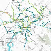
The Circuit Trail system takes advantage of the many opportunities to build and connect trails across the region that is a product of the area’s success in re-purposing unused rail corridors and developing linear parks along the region’s waterways. Indeed, one of the major goals of the Circuit is to provide access to the region’s rivers, creeks and streams. Just as importantly, the Circuit will also serve as the backbone for a network of "bicycling highways" that will allow safe and efficient travel by bicycle between homes, businesses, parks, schools and institutions free from motorized traffic. Click here for a map of The Circuit Trails.
The Circuit Trails - Interconnected trails in the Greater Philadelphia region.
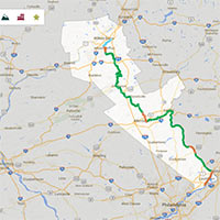
The D&L Trail follows the 165-mile route that anthracite coal took from mine to market. It winds through northern mountains and along the banks of the Lehigh and Delaware Rivers through northeast Pennsylvania, the Lehigh Valley and through Bucks County. The D&L Trail passes through towns, industrial powerhouses and along remnants of the Lehigh and Delaware canals. This earthen path exposes walkers, hikers, bicyclists and others to some of Pennsylvania's finest wild lands, waterfalls, wildflowers and wildlife.
Delaware & Lehigh Trail
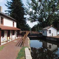
America’s history is reflected along the entire 60-mile length of the Delaware Canal. Delaware Canal maps, trails and charts are available to help you plan your hike on the beautiful canal. A wealth of recreational options await including hiking, biking, boating, fishing, horseback riding, nature watching, cross country skiing and ice skating.
Friends of the Delaware Canal

Montgomery County offers its residents and visitors a premier trail system. The Montgomery County Division of Parks, Trails, and Historic Sites is responsible for constructing and maintaining all county trails. We currently have almost 60 miles of regional county trails connecting greenways, waterways, and heritage corridors within Montgomery County and are planning to construct additional trail miles.
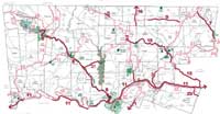
Montgomery County Trail Network

Our trails offer panoramic views, wildlife observation, waterways, natural areas, and insight to the history or Lehigh County. Those looking for a challenge can hike or mountain bike the challenging 8.5 mile Border Trail at Trexler Nature Preserve. Those interested less strenuous trails will enjoy the ADA trail at Trexler or Lehigh County's 11 miles of the D&L trail along the Lehigh River from Cementon to the Lehigh Gap Nature Center. Our trails connect to other trails including the 2200 mile Appalachian Trail, other sections of the 165 mile D&L Trail, the Jordan Creek Greenway, the Slate Heritage Trail, the Ironton Rail Trail and the 14 miles of trails at the Lehigh Gap Nature Center.
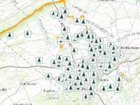
Lehigh County Parks Map

The Route 202 Parkway trail is an almost nine-mile long, 12-foot-wide paved trail along the new parkway running from Doylestown to Montgomeryville. There are 5 trailheads with parking at Knapp Road, Route 309, Stump Road near the County Line Road intersection, Bristol Road, and New Britain Road. Trail Map >
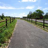
202 Parkway Trail
Trails.com is designed for outdoor enthusiasts by outdoor enthusiasts, bringing you thousands of trail guides, topographic maps, tips and useful information for hiking mountain biking, snowshoeing, mountaineering, trail running and water sports. The details of trails in the Clinton area are very helpful!
Trails.com
Doylestown Borough is a bike friendly community. Bike racks are provided through out town so riders can park their bike while they shop, visit and dine. The Doylestown Community Bike and Hike Network is a network of 16 miles of completed trails, shared roadways and side-paths for use by bicyclists and pedestrians. The Doylestown trails connect to the larger Pennsylvania system of trails, including Bicycle Route “S”, and the 202 Parkway trail, which includes a shoulder bike lane and a separate paved 12-foot wide multi-use trail.Click for map.
Doylestown Bike and Hike
Completed in 1875, this former rail line was established by the Central Railroad of New Jersey as the High Bridge Branch. The line ran from High Bridge to Port Oram, currently known as Wharton, in Morris County. The wooden trestle was replaced by steel piers in 1930 and is now known as the Ken Lockwood Gorge Bridge. Today the trail spans seven miles from High Bridge to the Morris County line. It provides passive recreation to the surrounding communities through hiking, biking, and cross-country skiing.
Columbia Trail in Hunterdon County, New Jersey
There are now over 5 miles of paved trail at WCP! Several trails bisect the park to create a multitude of walking, biking and running opportunities. Along the way, you'll experience some hidden park treasures and enjoy much of the wildlife. Click for map.
Warminster Township Park Trail
This linear park is 3.7 miles in length and connects Tyler State Park with Newtown Township's Silver Lake Park. It travels along Green Lane to Council Rock North High School, then travels east along Swamp Road to Sycamore Street. Click for map.
Newtown PA Trail
This website has a nice list of trails in and around the Clinton area. TrailLink is a free service from Rails-to-Trails Conservancy, a non-profit organization dedicated to assisting local communities in converting unused railroad corridors into community trails. Since 1986, RTC has worked from coast to coast, supporting the development of thousands of miles of rail-trails for millions to explore and enjoy. RTC has helped craft rural trails that spool out over a hundred miles of open prairie, snake through mountain passes, span canyons and hug riverbanks, offering views of the countryside often unknown to the highway traveler. We’ve been a part of the connections between towns and suburbs, linking communities along vibrant corridors in much the same way as the railroads did in their heyday.
TrailLink
ExplorePAtrails.com is a portal for sharing and exploring Pennsylvania trails information. The website features an interactive map, driving directions, a forum for updating trails information, and a place where people can upload reviews and share stories about their favorite trails.
Explore PA Trails
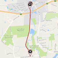
The Landsdown Trail adjoins the South Branch of the Raritan River. Over 1000 acres of parkland exist along this river, and these pieces collectively are called the South Branch Reservation. This reservation provides recreational opportunities, helps preserve the watershed from development, and provides wildlife habitat. Visit the county park website for trail maps and guides for these other park areas. Click here for a detailed map of the Landsdown Trail.
Landsdown Trail, Clinton NJ
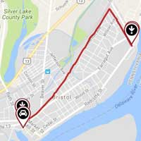
The path incorporates the rail corridor and some of the former canal towpath, carrying trail users to the Bristol Marsh, a unique and sensitive freshwater habitat. Traversing downtown Bristol, this residential trail eventually will provide public access to the Delaware River and waterfront at the end of Green Lane. This smooth asphalt trail also connects with nearby ball fields, grassy parks, retirement communities and an elementary school.
Bristol Spurline Park